
2023. June 07.
Charles Toth is an honorary doctor of BME
On the proposal of the Faculty of Civil Engineering, the Senate of BME awarded Charles Toth the title of Honorary Doctor at its ceremonial meeting on 3 June 2023.
Charles Toth has been at The Ohio State University (OSU) for 35 years, and since 2013 he has been a research professor in the Department of Civil, Environmental and Geodetic Engineering. He is an internationally recognized expert in photogrammetry, remote sensing, geomatics, sensors, navigation and mobile mapping technologies. He has been elected Fellow of three organizations, has received numerous awards and has held many leadership roles, including President of the American Society for Photogrammetry and Remote Sensing (ASPRS) and Vice President of the International Society for Photogrammetry and Remote Sensing (ISPRS).
Over the last three decades, Charles Toth has developed a significant and close collaboration with the Faculty of Civil Engineering of the BME, with 10 staff and PhD students of the Faculty having spent at least 6 months of research under his leadership at OSU.
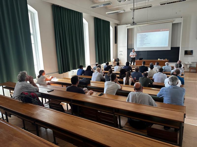
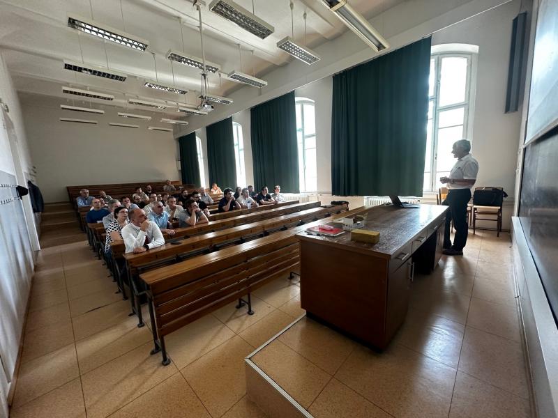
Charles Toth at the Detrekői seminar on 2 June 2023 on „Trends in geoinformatics: sensor integration, crowdsourcing and autonomous systems”
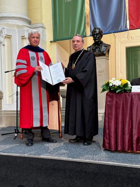
Awarding the Honorary Doctor title
Early in his career, Charles Toth was the key architect of the concept development and implementation of the first mobile mapping system (MMS), one of the first civilian applications of GPS. He is considered one of the founding fathers of MMS and is recognized worldwide for his contributions for advancing MMS technology and its applications. This revolutionary technology became the frontrunner of acquiring street data for visualization to support location-based services, with thousands of vehicles equipped with the latest sensors acquire data 24/7 for the Internet-based giants. For the past 25 years, he has been one of the three international leaders organizing the International Symposium on Mobile Mapping Technology (MMT), an international professional entity focused on advancements in navigation and imaging, and their applications to digital mapping, city modeling, emergency response, unmanned vehicles, precision farming, personal navigation, indoor navigation, etc.
In late 1990s, Charles Toth led the OSU team in the groundbreaking project Airborne Integrated Mapping System (AIMS), which delivered first in the world fully digital directly georeferenced high-accuracy airborne mapping system prototype based on tight integration of GPS and inertial navigation unit (IMU). In fact, this technology was first commercially used during the Ground Zero emergency mapping operations, providing essential feedback to refining the entire workflow. Subsequently, Charles Toth led significant research effort on direct georeferencing of remote sensing platforms, introducing GPS/IMU based sensor orientation into the mapping community, and is generally credited with coining the terms “direct and indirect georeferencing”.
Notably, Charles Toth was the lead mapping expert to support navigation for the OSU team in the three DARPA Ground/Urban Challenges (2004, 2005, and 2007). He was an early advocate of using complex geospatial data, such as terrain models and imagery to support vehicle navigation to improve localization and robustness of scene understanding. These pioneering efforts have greatly contributed to the rapid development of assisted and autonomous vehicles technologies.
In addition to the three major accomplishments listed above, Charles Toth has designed and developed a number of prototype systems to conduct research in mapping and navigation, including various backpack navigation and mapping systems to support dismounted warfighters and emergency responders, indoor navigation and mapping, pushcart platforms to study collaborative navigation, and UAS systems. He led multiple field campaigns to performance test the prototype systems in collaboration with other research groups worldwide, including numerous tests at OSU, navigation reference data acquisition tests at AFRL in Dayton, collaborative navigation tests at the Nottingham Geospatial Institute and University of Melbourne, pushcart navigation at UNSW, Mars rover decent simulation data acquisition at the Death Valley, navigation and georeferencing at Yuma Proving Ground, airborne gravity surveys at the North Pole, the Sierras in the US and the Andes in South America, sensor validation at NASA Stennis Space Center.
He published over 400 peer reviewed journal and proceedings papers, numerous technical reports and six book chapters on photogrammetry, LiDAR, and navigation, and led nearly 60 sponsored research projects with the total budget of over $25 million. His primary research sponsors are Department of Defense (DoD), Strategic Environmental Research and Development Program (SERDP), Environmental Security Technology Certification Program (ESTCP), National Geospatial-Intelligence Agency (NGA), NASA, Ohio and Federal Department of Transportation, The Defense Advanced Research Projects Agency (DARPA), Air Force Research Lab (AFRL), NSF, National Geodetic Survey (NGS). He served as a lead co-PI on NGA/USGS National Centers of Academic Excellence in Geospatial Science Education Program Application (2015-18).
Charles Toth has held many senior leadership positions in national and international societies. He was elected Director of Photogrammetric Application Division of ASPRS (2004-2006), National Director of Eastern Great Lakes Region of ASPRS (2008-2014) and President of ASPRS (2015-2017). He was chairing multiple Working Groups of ISPRS (1996-2012), elected President of ISPRS Technical Commission I (2012-2016) and Vice-President of ISPRS (2016-2021), and is the Chair of the ISPRS Scientific Advisory Committee (2022-2026).
Charles Toth’s international research collaborations and recognized broad expertise enabled him to act as an ambassador to facilitate the establishment of professional partnerships between ASPRS, ION and ISPRS, FIG, and IAG. Under his leadership, numerous international joint symposia sessions were organized leading to a significant exchange of new research ideas and advancing the state-of-the-art in geospatial science and engineering, and related disciplines. Serving ION for over 20 years in various capacities, Charles Toth has contributed to numerous meetings, as session chair, panelist, author, moderator, etc. He taught numerous workshops and short courses for professional societies, including ION, industry, graduate and undergraduate students at various national and international universities and institutions. He is a frequent keynote and invited speaker, and guest editor. As an academic educator, he graduated 45+ MSc and PhD students, and mentored 25+ post-doctoral and visiting scholars, contributing to educating and training numerous new generation navigation and remote sensing science leaders.
Charles Toth is a Fellow of three professional societies: American Society of Photogrammetry and Remote Sensing (ASPRS), International Society of Photogrammetry and Remote Sensing (ISPRS) and the Institute of Navigation (ION) and is Life Senior Member of Institute of Electrical and Electronics Engineering (IEEE). He is the recipient of many prestigious awards, including the 2005 and 2015 United States Geospatial Information Foundation (USGIF) Academic Research Award, OSU College of Engineering Lumley Research Award (2007, 2008, 2013), 2009 ASPRS Photogrammetric Award (Fairchild), 2016 ISPRS Schwidefsky Medal, 2021 ION Captain P.V.H. Weems Award, 2022 Carl Pulfrich Award.
Charles Toth has developed an extremely close and successful cooperation with the BME; in particular, with the Department of Photogrammetry and Geoinformatics and with the Department of Geodesy and Surveying. Early on his career, he met Prof Akos Detrekoi and they immediately started to work on remote sensing, an emerging research topic of that time. This initial collaboration later expanded into other areas and was formalized in a MOU signed between BME and OSU. This agreement facilitated student exchange, hosting visiting scholars, joint research and participation in ISPRS activities. Notable examples are:
- Joint publications with Bence Molnar, Sandor Laky, Piroska Zaletnyik, Arpad Barsi, Tamas Lovas, Gabor Melykuti, Bence Takacs, Zoltan Toth, Akos Detrekoi, Zoltan Koppanyi.
- Dissertation advisor/co-advisor of Tamas Lovas and Zoltan Koppanyi
- Hosting visiting scholars at OSU: Jozsef Adam, Gyorgy Szabo, Lorant Foldvary, Bence Molnar, Piroska Zaletnyik, Sandor Laky, Zoltan Koppanyi.
- Organizing international events hosted by BME, such as NASA/FDOT project meeting or ISPRS Council Meeting
- Giving presentations such as DARPA Grand/Urban Challenge, 50th Year Anniversary Seminar of the Department of Photogrammetry and Geoinformatics.
Charles Toth has followed a brilliant academic career, encompassing a remarkable sequence of teaching, research and business successes. At the same time, he has participated actively in professional societies, especially ASPRS, ISPRS and the Institute of Navigation (IoN) and is a Fellow of all three organizations. While he has been always closely connected to his alma mater, his collaboration with BME has been extremely strong and productive, resulting in joint research, student exchange, faculty scholarship, organizing meetings and publications.